
When storms turn severe, two alerts dominate your phone, TV, and weather apps: tornado watch and tornado warning. They sound alike, but they signal very different levels of risk and very different actions. This guide breaks down the difference in plain English, then goes deeper into how alerts are issued, how to prepare, and what to do in real-life scenarios.
The One-Sentence Rule You’ll Actually Remember
-
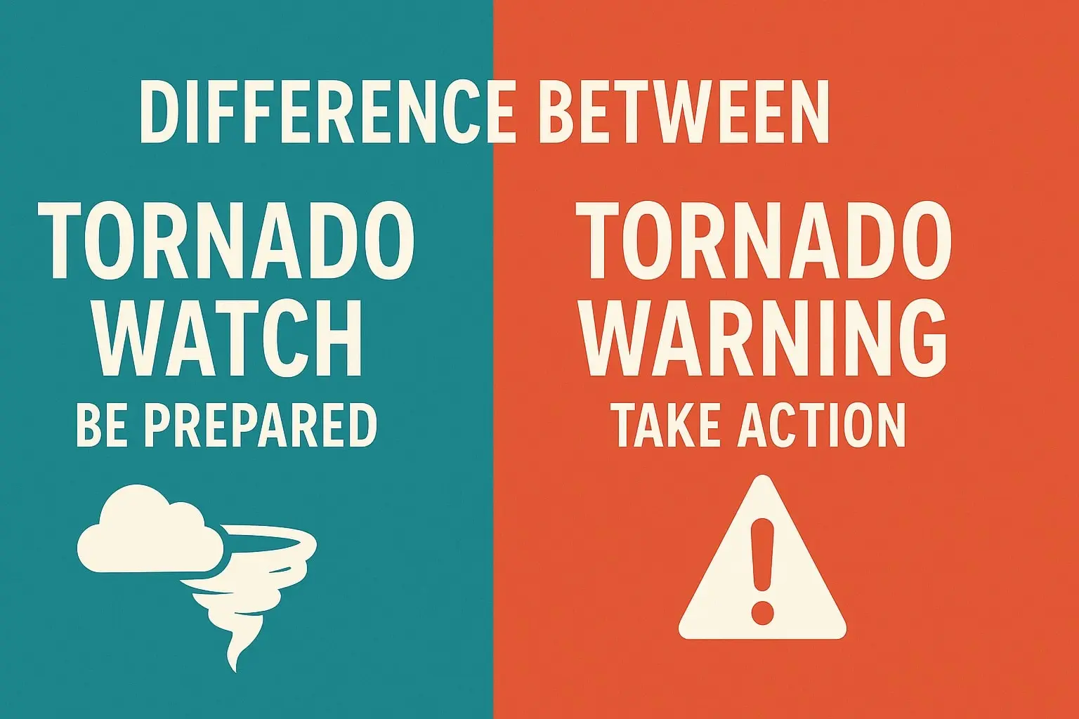
Watch = Conditions are favourable for tornadoes. Prepare and stay alert.
-
Warning = Tornado detected by spotters or radar. Take shelter immediately.
What a Tornado Watch Really Means
A tornado watch is a heads-up that the atmosphere has the ingredients to produce tornadoes over the next several hours.
Key traits
-
Scope: Large area (several counties or multiple states)
-
Duration: Typically 3–8 hours
-
Evidence: No confirmed tornado yet; forecasting shows heightened potential
-
Your move: Review your plan, charge devices, keep shoes and helmets accessible, monitor updates
How it’s issued
Storm prediction specialists analyse instability, wind shear, moisture, and lift. If multiple parameters align, they issue a watch to buy you time.
What a Tornado Warning Really Means
A tornado warning is an act-now alert that a tornado is occurring or imminent.
Key traits
-
Scope: Smaller area (a county, a few towns, or a storm’s immediate path)
-
Duration: Often 15–60 minutes
-
Evidence: Visual confirmation or radar-indicated rotation/debris
-
Your move: Go to your safe place now—no errands, no “quick look outside.”
Where to shelter (ranked)
-
Underground: Basement or storm cellar
-
Interior on lowest level: Small room or hallway away from windows
-
Mobile homes: Leave for a sturdy shelter if time allows
-
High-rises: Interior hallway/bathroom, low as possible
Side-by-Side Comparison
| Feature | Tornado Watch | Tornado Warning |
|---|---|---|
| Meaning | Conditions could produce tornadoes | Tornado spotted or radar-confirmed |
| Urgency | Elevated risk | Immediate danger |
| Area | Large (regional) | Local (storm track) |
| Action | Prepare, monitor | Take shelter now |
| Typical Duration | Hours | Minutes to an hour |
What Happens Behind the Scenes (Simplified)
-
Forecast stage: Models show instability + wind shear → watch likely.
-
Watch issued: Broad heads-up for the region.
-
Storm matures: Rotation tightens; radar signature strengthens.
-
Warning issued: Tornado confirmed or imminent along a narrow path.
-
Polygons update: Short, targeted extensions as the storm moves.
Understanding this pipeline explains why you might be in a watch for hours and then suddenly get a warning with only minutes to act.
Real-World Scenarios You Can Practice
Scenario A: Afternoon Watch
-
2:00 PM: Your county enters a tornado watch.
-
What you do: Bring in outdoor items, set phone to loud alerts, move car into garage, keep sturdy shoes/helmets by the door.
Scenario B: Evening Warning
-
7:46 PM: Phone blares—Tornado Warning for your town until 8:15 PM.
-
What you do: Go to your shelter spot immediately; protect your head; keep pets and kids with you; monitor updates via radio/app.
Scenario C: Nighttime “Radar-Indicated” Warning
-
1:12 AM: You’re asleep; Wireless Emergency Alert wakes you.
-
What you do: No window checks. Grab shoes, flashlight, helmets, and shelter now. Night storms are deadlier—reaction time matters.
Preparedness Checklist (Copy/Paste for your fridge)
-
Battery or crank weather radio
-
Helmet for each person; sturdy shoes
-
Whistle or air horn (for after-storm signaling if trapped)
-
Phone chargers, power bank, small first-aid kit
-
Pet leash/carrier; baby supplies as needed
-
List of local shelters; know the lowest, most interior room in your home
-
Turn on Wireless Emergency Alerts on your phone and enable app notifications
Safety for Specific Situations
-
In a vehicle: Do not try to outrun a tornado in city traffic; if you can safely reach a sturdy building, do it. As last resort, stay buckled, head below window level, cover with a blanket.
-
In a mobile home: Leave for a designated shelter when a watch is issued, not when the warning arrives.
-
At school or work: Follow the emergency plan; avoid large open rooms like gyms or cafeterias.
-
For people with disabilities: Pre-identify accessible shelter routes and assign a safety buddy.
Common Myths—Busted
-
“Highways or overpasses are safe.” False. Wind accelerates through the overpass “tunnel.”
-
“Tornadoes don’t cross rivers or hills.” False. Terrain doesn’t stop them.
-
“Opening windows reduces damage.” False. It wastes time and increases risk.
-
“If I can’t see it, it’s not close.” False. Rain-wrapped tornadoes are invisible.
Quick FAQ
Is a watch ever upgraded to a warning?
Not automatically. A warning is issued if a storm inside the watch area produces a tornado threat.
Why do warnings sometimes end early?
If the storm weakens or changes track, the warning polygon is trimmed to limit false alarms.
What if I’m outside the polygon but still in the county?
Follow guidance for your exact location; polygons are precise. Don’t rely on county-wide assumptions.
Smart Tech to Reduce Risk
-
Enable Wireless Emergency Alerts (WEA) on iOS/Android.
-
Use a reputable weather app with location-based warnings.
-
Keep a NOAA Weather Radio as a backup if power or cell service fails.